This section guides you through the process of adding new records (new data with information) into the GeoNetwork catalogue using either the online metadata editor or the advanced metadata insert tool, based on XML documents. In both cases you will use the template system, add thumbnails, upload data, link to services and set access privileges to the metadata and data.
To add or edit data and metadata, you must be registered as an Editor into the work group you want to add records to. Contact your administrator if you are not a registered editor for your work group.
For the metadata creation using the online editor, GNos provides a set of simplified metadata templates based on the cited standards: ISO, FGDC and DC. The templates for vector and raster based on the ISO 19139 are the preferred ones since they are devised in a way that hides the complexity of the ISO19115 standard in the default view. At the same time those templates are extensible with new elements to fit specialized needs through the advanced view.
To produce a good metadata record, always try to gather as much details as possible on the resource that you want to describe taking into account the metadata elements that have been presented in the previous chapter. The next step is to fill out properly the fields provided by the metadata templates, while at the same time avoiding duplication of information throughout the form.
The most important fields that may not be waived while compiling a standard based metadata record are the following: Title, Date of Creation o Publication, Abstract, Language used for documenting data, Topic Category, Scale, Maintenance and Update Frequency, Metadata Author, Language Used for Documenting Metadata.
In addition to the main mandatory fields, we recommend you to fill out these optional but critical fields (if information is available): Purpose - Keywords - Presentation Form - Status - Spatial Representation Type - Geographic Location - Reference System Info - Temporal Extent - Data Quality Info - Access and Use Constraints - Point of Contact - Distribution Info: Online Resources.
You should also prepare an image of your data that is required to be displayed in search results as thumbnail.
Next section will guide you through the process of metadata creation using the online editor.
In the home page, click on the Administration Tab.
Select New Metadata from the List of the admin page.
Select the metadata standard Template, if possible, using the preferred ones (Figure 4.3, “Template selection”). GeoNetwork opensource comes by default with support for three metadata standards, ISO19139, FGDC and Dublin core. For the ISO standard, two templates have been developed; one for vector and one for raster data. Both contain a relevant set of elements to describe the respective types of data. More templates can be developed online.
Select the Group the metadata will belong to. These are the groups authorized to add metadata to by your administrator.
Click on Create.
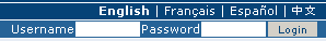
Enter your username and password and click on the login button (Figure 4.1, “Login”). The system will identify you and assign the correct privileges to work with.
Open the Administration page by clicking the Administration button in the banner and then click on the New metadata link (Figure 4.2, “Administration panel”).
From the metadata creation page, select the metadata standard to use from the dropdown list (Figure 4.3, “Template selection”)
After selecting the correct template, you should identify which group of users the metadata will belong to (Figure 4.4, “Group selection”) and finally click on Create.
A new metadata form based on the selected template will be displayed for you to fill out.


Once you create a new record, you can choose between Default, Advanced or XML View. To switch view, simply click on the view you want to switch to on the left column of the page. The view in bold is the view you are currently using (Figure 4.5, “Metadata view options”).

In the previous chapter you have analyzed the metadata structure as it is presented in the Default View. A selection of the main fields from different categories of information is shown in one single view. The minimum set of metadata required to serve the full range of metadata applications (data discovery, determination of data fitness for use, data access, data transfer and use of digital data) is defined here, along with optional metadata elements to allow for a more extensive standard description of geographic data, if required. However, if should be there a need to add more metadata elements, you can switch to the advanced view at any time while editing.
In the Advanced View, the ISO profile offers the possibility to visualize and edit the entire metadata structure organized in sections accessible through tabs from the left column. You can use this view to write more advanced metadata descriptions or templates to fit specialized needs. (Figure 4.6, “Advanced view”)

The XML View shows the entire content of the metadata in the original hierarchical structure; different colors allow to distinguish between an element's name and its value. The XML structure is composed of tags and to every tag must correspond a closing tag (Figure 4.7, “XML view”). The content is entirely contained withing the two, i.e.
<gmd:language>
    <gco:CharacterString>eng</gco:CharacterString>
</gmd:language>
Nevertheless, the use of the XML view requires some knowledge of the XML language.
Both the Default and the Advanced Views are composed of
mandatory, conditional and
optional metadata fields. The meaning of mandatory and
optional is fairly intuitive; the mandatory fields are required, like
Title and Abstract for instance,
whereas the optional fields can be provided but are not fundamental, depending
on the metadata author. The conditional fields may be considered mandatory under
certain circumstances: essentially a conditional requirement indicates that the
presence of a specified data element is dependent on the value or presence of
other data elements in the same section. For instance, the Individual
name metadata element of the Point of Contact,
which is a conditional element of the Identification section, becomes mandatory
if another element of the same section, Organization name or
Position name is not already defined (Figure 4.8, “Point of Contact”).

The mandatory fields as well as those highly recommended are flagged with red asterisk [*]. The standard definition for each field can be read by passing the mouse on the element name.
The Default View is the preferred view as it provides a selection of the available metadata elements, facilitating both the user and the editor in reading and editing a metadata record, and at the same time it ensures that a geospatial data can be properly described, through :
the minimum set of metadata required to serve the full range of metadata applications (data discovery, determination of data fitness for use, data access, data transfer, and use of digital data);
optional metadata elements - to allow for a more extensive standard description of geographic data, if required;
a method for extending metadata to fit specialized needs.
Fields are either free text fields or drop down lists. Free text means you can type any text into that field. Drop down lists allow you to select only one option from the list. You can add multiple fields of the same kind by clicking on the [+] symbol next to the element. Every new field that you will add in the advanced view will then be visible in the default view. You can also delete existing fields by clicking on the [x] symbol next to the element. Clearly, mandatory fields cannot be deleted. One example of the need to add multiple fields can arise if the content of your dataset has some text written in two different languages (Figure 4.9, “Describing multilingual data”).
